|
Seguici su
   
|

- GAP offre una vasta gamma di prodotti e servizi per il monitoraggio ambientale e la mappatura di aree a rischio idrogeologico
mediante indagini e metodologie che fanno uso di dati telerilevati da satellite nonché di misure in situ.
Qui di seguito riportiamo le principali aree di competenza del nostro spin-off.
Analisi interferometriche multitemporali effettuate con tecnica SPINUA © (Stable Points INterferometry on Un-urbanised Area) per la generazione di DSM ad elevata risoluzione e il rilevamento di movimenti millimetrici superficiali del terreno (sensors ERS, ASAR, RADARSAT, COSMO-SkyMed, TerraSAR-X, ALOS PALSAR).
Maggiori informazioni qui

Telerilevamento satellitare con sensori ottici (a basse e/o elevate risoluzioni spaziali e temporali) per il monitoraggio dello stato di salute di ecosistemi marini e del loro grado di eutrofizzazione.
Misure in situ di parametri di chimici e biofisici di qualità dell'aria e delle acque.
Maggiori informazioni qui
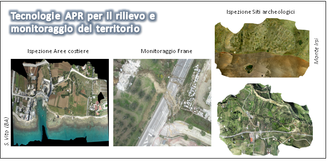
Monitoraggio Frane (ortofoto e 3D). Ispezione edifici, monumenti, ponti, dighe, tralicci (video HR). Ispezione siti rischiosi (video HR).
Ispezione pale generatori eolici (Foto e Video HR). Discariche (ortofoto e volumetria). Cave (ortofoto e volumetria). Siti Archeologici (ortofoto).
Monumenti (ricostruzione 3D). Edilizia (ortofoto alta risoluzione e DSM).
Maggiori informazioni qui
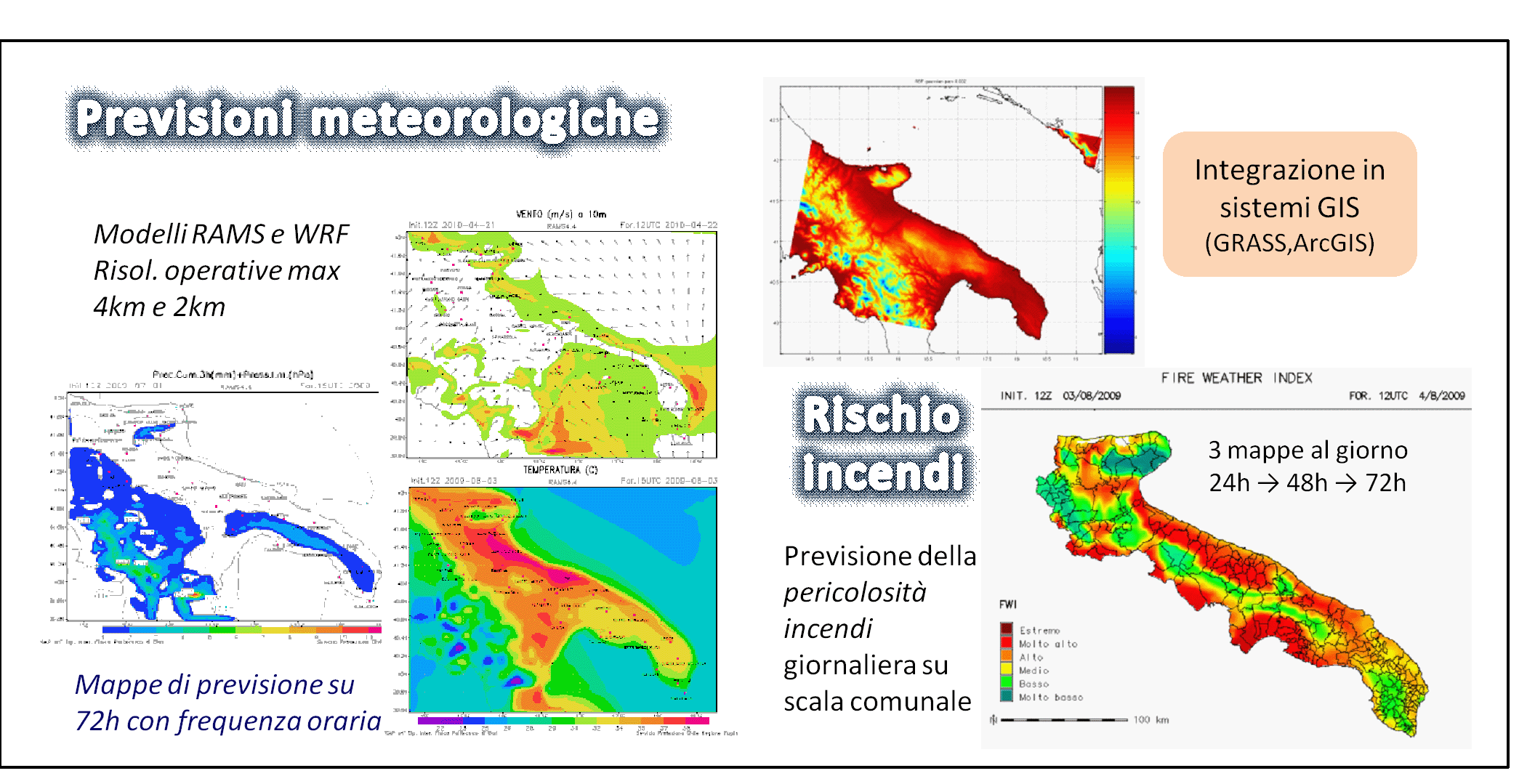
Servizi di previsione meteorologica ad elevata risoluzione attraverso modellistica numerica. Catene modellistiche per la previsione dei rischi ambientali (incendi, idrogeologico). Elaborazione dati meteo-climatologici. Reanalisi eolica.
Maggiori informazioni qui
- La pluriennale esperienza maturata nel settore della elaborazione numerica dei segnali ha consentito a GAP di trasferire gli algoritmi sviluppati per il Telerilevamento anche in altri ambiti ove sono richieste tecniche avanzate di trattamento digitale dei dati.
Esempi di questo trasferimento tecnologico sono:
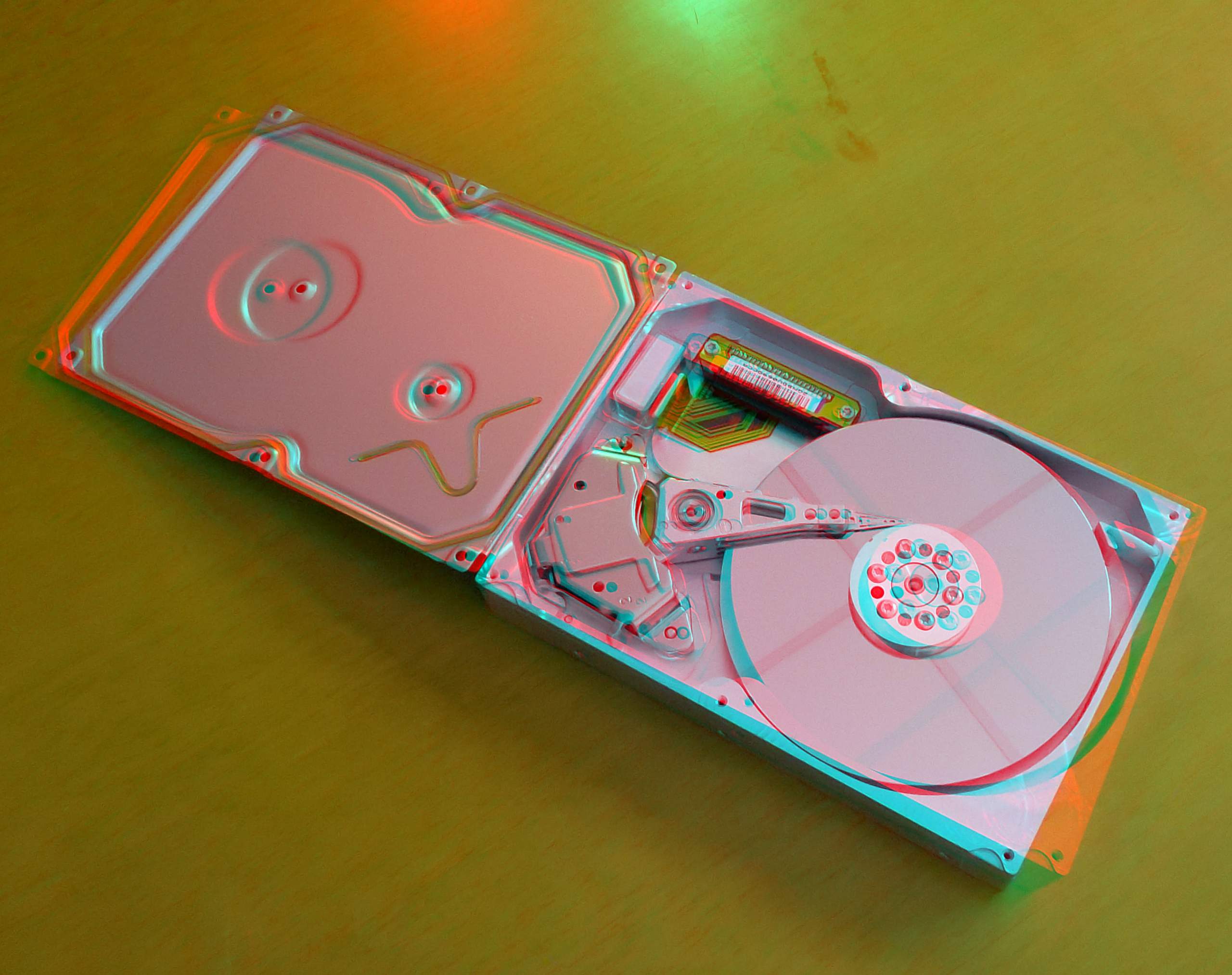
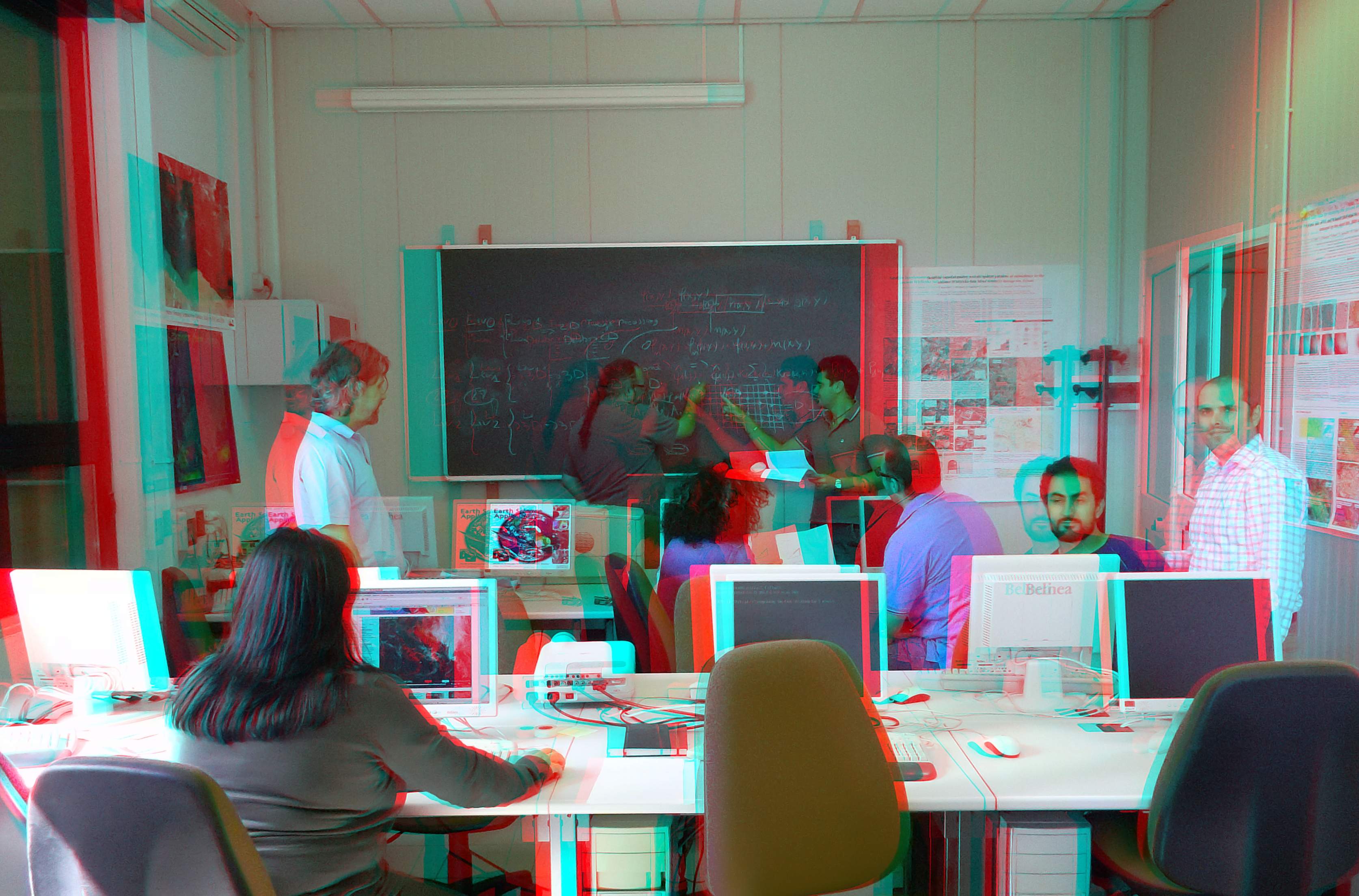
Immagini a carattere puramente illustrativo: immagini stereoscopiche (anaglifi)
di un hard disk (sinistra) e della sala formazione di GAP srl (centro); Risconoscimento e tracking di oggetti 3D da immagini digitali (destra).
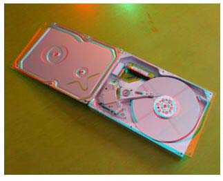
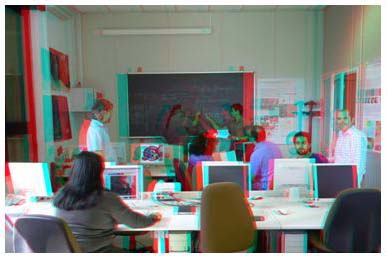
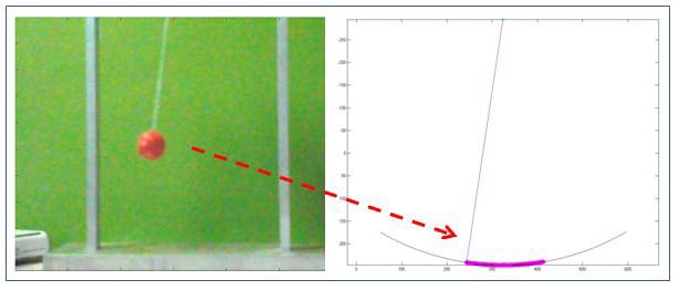
Clicca per ingrandire le immagini
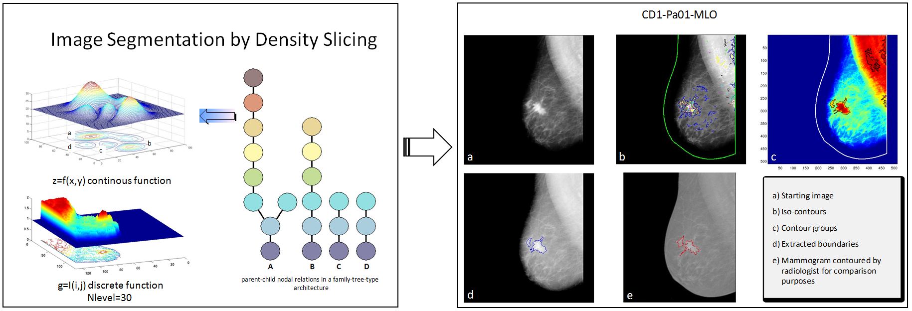
Applicazioni per analisi mammografiche: rilevamento automatico di masse tumorali ed estrazione dei relativi contorni.

Clicca per ingrandire le immagini
- Il know-how sinora maturato nei diversi ambiti dell'elaborazione numerica dei segnali ha altresì portato allo sviluppo e all'implementazione di una suite software commerciale disponibile sul mercato, denominata:
GAP STEREO VISION è una suite modulare di tools software progettati per l'elaborazione avanzata di dataset di immagini radar e ottiche al fine di:
- Estrazione e posizionamento accurato di features e forme: esempi delle molteplici applicazioni vanno dal rilevamento automatico di aree inondate o esondate a quello di masse tumorali in diagnosi mammografiche, e comprendono anche modelli digitali del terreno ad alta risoluzione, riconoscimento di pattern, ecc.
- Tracking di oggetti e target: esempi applicativi includono la misura degli spostamenti del terreno (subsidenze, frane, earthquakes, etc.), misura di onde marine, tracking e correzione di posizione e assetto di piattaforme missilistiche e UAV, ecc.
Clicca per ingrandire le immagini
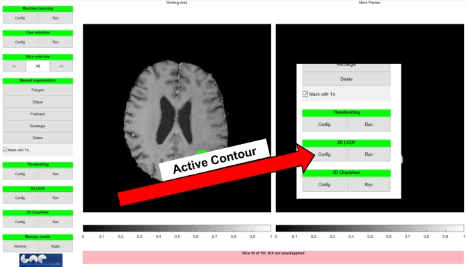
La segmentazione di immagini di risonanza magnetica rappresenta un passo fondamentale in diversi ambiti medicali.
In tale contesto, il GAP Software Lab realizzato da GAP nell'ambito del progetto SINACH si offre come soluzione in grado di soddisfare sia l'operatore che necessita di risultati affidabili in tempi molto rapidi sia l'operatore più esigente che desidera sperimentare diverse soluzioni di segmentazione quali ad esempio le tecniche di segmentazione basate su metodi di tipo active contour o sperimentando anche la combinazione di più tecniche di segmentazione, partendo ad esempio da tecniche di thresholding andandole poi a rifinire con tecniche di active contour, o nei casi più complessi operando manualmente con tutta una serie di tool di refinement manuale che consentono di agire anche a livello della singola slice da segmentare.
Il video descrittivo di questo software è disponibile al seguente link:
https://youtu.be/wFYANr8tJy0
Acknowledgement: si ringrazia il Prof. Andrea Guerriero del Politecnico di Bari per il supporto tecnico e scientifico fornito al team di sviluppo di GAP composto da Khalid Tijani, Alberto Morea e Raffaele Nutricato.
Brochure
|
|