|
Using persistent scatterers technique with SPINUA © it is possible to monitor slow moving landslides and to provide important signals for a landslide warning system.
The example is relative to a study of Maratea landslide conducted in collaboration with Geocart.
The methodology has been developed and tested in the LEWIS eurpean project and has been applied in other investigations in different European countries.
The key element in the LEWIS project is to avoid trying to infer absolute values of relevant geophysical parameters from EO data, but only their changes in time in the wider sense of "deviations from a known temporal evolution model". Other periodic information, relevant for this project, can be obtained from existing ground networks for rain and earthquakes.
The detected changes have to be integrated into a GIS, together with other more static parameters, and used to infer potential slope stability changes and to produce Early Warning.
Therefore, the LEWIS Early-warning maps are obtained through the detection of temporal ground surface changes, associated with static landslide susceptibility mapping. Interpretation of the change maps, processed in automated mode by incorporating expert knowledge into an inference engine leads to a warning that the detected changes are leading towards a slope instability condition.
|

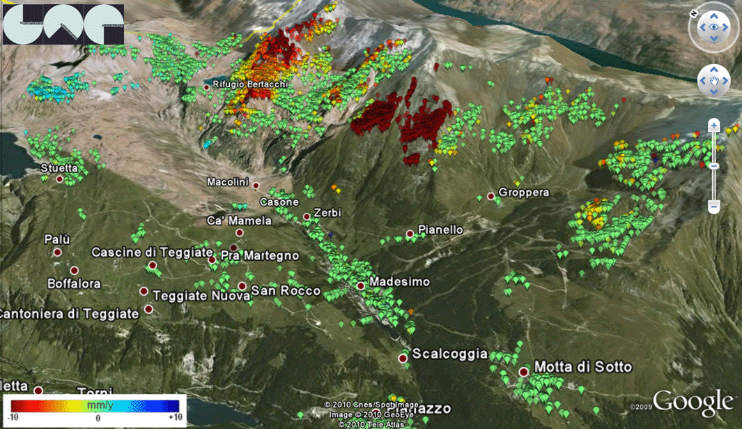
Landslide in Madesimo (Italy)
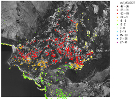
Slow ground movements in Maratea (Italy)
|